The $407.5 million duplication of the Southern Expressway will deliver an 18.5 kilometre multi-lane, two-way expressway between Bedford Park and Old Noarlunga by mid-2014.
For more information about detours, please contact Bernie Auricht, Community Liaison Representative of the Southern Expressway Duplication (SED) on Ph. (08) 8168 6627, via email BAuricht@bajvsed.com.au or visit the website of the Department of Planning, Transport and Infrastructure at www.infrastrucutre.sa.gov.au.
Recent communication:
—————————————————————–
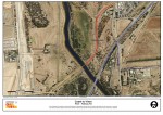
 In conjunction with the State Government, Onkaparinga Council has constructed the Coast to Vines (C2V) Trail. The section between River Rd and Railway Tce is in poor condition and at the end of its lifecycle. Patching works along the 1.2km section have recently been completed and reseal works between River Rd and the Onkaparinga Bridge will be undertaken within the next few weeks. See attached map The reseal works will occur between 1st and 14th March 2013. Once works have commenced, the trail will be closed for up to three days.
Users, especially cyclists are encouraged to find alternate routes during this time.
—————————————————————–
22 January 2013
Closure of Glenhelen Path – late January to mid May 2013
Upcoming closure of Glenhelen Path to enable this pedestrian bridge to be extended for the Southern Expressway Duplication project.
The closure will be in place from late January to mid May 2013, during which time both earthworks and bridge construction works will take place to extend the pedestrian bridge.
During these construction works pedestrian and cyclist access will not be available across Glenhelen Path, with alternative access available via Flaxmill Road.
Advanced warning signs will be in place to advise pedestrians and cyclists of the changed traffic conditions and all detours and changed conditions will be clearly marked.
Construction hours are 6.00am to 7.00pm Monday to Saturday.
For further information on construction activities, please contact the Project Team by phoning 1300 626 097. Alternatively log onto the project website www.dpti.sa.gov.au/southern_expressway_duplication or email SEDenquiries@bajvsed.com.au
—————————————————————–
14 December 2012
Refurbished Coast to Vines Rail Trail route between Railway Road and Griffiths Drive (click image to view)
The reinstated Coast to Vines Rail Trail alignment provides grade separation from the crossing of the Onkaparinga River through to a signalised crossing at Griffith Drive.
If you have any further queries, please do not hesitate to contact Kath on the Project Enquiry Line on: 1800 791 883 or email:sre.enquiries@tmdjv.com.au
—————————————————————–
5 December 2012
Upcoming closure of the Peppermint Path pedestrian bridge that crosses the Southern Expressway between Huntfield Heights and Noarlunga Downs.
CLICK HERE for the flyer.
————————————————————–
29 November 2012
There is an upcoming closure of the Coast to Vines shared use path at the Lander Road location and the subsequent detour of all pedestrians and cyclists to Lander Road underpass on 30th November. This closure coincides with the reopening of Lander Road for the afternoon peak on 30th November.
For more information (flyer) CLICK HERE.
&&&&&&&&&&&&&&&&&&&&&&&&&&&&&&&&&
27 November 2012
There are upcoming changes to traffic conditions on Flaxmill Road at the Expressway.
Access for emergency services vehicles, pedestrians, cyclists, motorists and public transport will be maintained during these works.
For more information (flyer) CLICK HERE.
&&&&&&&&&&&&&&&&&&&&&&&&&&&&&&&&&&&&&
17 November 2012 – Honypot Road Closure
This is to advise of an upcoming two day closure of Honeypot Road to allow service relocations to be undertaken by SA Power Networks. Minor pavement works will also be undertaken at this time.
Access for pedestrians, cyclists, emergency services vehicles and public transport will be maintained during this short-term closure.
To download the flyer, CLICK HERE.
***********************************************************************************************
Due to work on Beach Road (north lane), as part of the duplication of the Southern Expressway, there are some changes to the Shared Use Path detour between Elizabeth and Beach Roads. Users exit off Selina Street onto Beach Road at the eastern path rather than the western path.
***********************************************************************************************
31 October 2012
POZNAN PATH CLOSED UNTIL APRIL 2013 From early November to late April 2013, the Poznan Path will be closed to allow for the expansion of the path through the Southern Expressway Duplication project. During this time both earth works and bridge construction will take place to extend the pedestrian bridge. During these construction works pedestrian access will not be available across Poznan Path, with alternative access available via either Beach Road or Honeypot Road.
The Department of Planning, Transport and Infrastructure acknowledges that this closure and detour will cause some inconvenience to cyclists and pedestrians and has subsequently planned works to minimise the periods of disruption and provide the most efficient detour routes. Construction hours are 6.00am to 7.00pm Monday to Saturday. Advance warning signs will be in place to advise pedestrians and cyclists of the changed traffic conditions, and all detours and changed conditions will be clearly marked.
For further information on construction activities contact the Project Team on 1300 626 097, visit www.dpti.sa.gov.au/southern_expressway_duplication or emailSEDenquiries@bajvsed.com.au.
***********************************************************************************************
10 September 2012
Construction of the Southern Expressway duplication is continuing and the coming weeks will see changes to current pedestrian/cyclist detours. Detours will be in place with traffic management and directional signage for guidance. A summary of these detours is as follows:
- Coast to Vines (Noarlunga Downs/Huntfield Heights) – The Coast to Vines Trail underpass at the southern point of the Southern Expressway re-opens today.
- Perry Path (Noarlunga Downs/Huntfield Heights) – the closure of Perry Path will coincide with this re-opening, closing on 11th September weather permitting. A detour will be in place on Corrimal Ave, River Road, Coast to Vines Trail and the shared-use trail to the east of the Southern Expressway.
Detours also remain in place for the following bridge/road closures:
- Seacombe Road
- Sturt River Underpass
- O’Sullivan Beach Road
- Elizabeth Road
- Moore Road
***********************************************************************************************
16 August 2012
Re: Cyclist and Pedestrian Detours for Southern Expressway Duplication
This message has been generated as part of our ongoing commitment to keep the cycling community informed about the Southern Expressway duplication project. Construction of the Southern Expressway duplication is continuing and the coming weeks will see more pedestrian/cyclist detours. Detours will be in place with traffic management and directional signage for guidance. A summary of these detours is as follows:
- Elizabeth Road/Beach Road (Morphett Vale/Hackham West): The shared use path to the east of the Southern Expressway has been detoured and will remain closed for the duration of the bridge/interchange construction at Beach Road (mid 2013). The detour utilises Columba St, Benet St, Elizabeth Rd, Selina St and a section of newly laid unsealed path.
- Lander Road Closure (Trott Park/O’Halloran Hill): the duplication of the Lander Road Overpass requires Lander Road to be closed from 17 August until late 2012. A detour for east/west travel will be implemented which will detour both cyclist and pedestrians onto Erin Place, Craig Avenue, the Patrick Jonker Veloway, Coast to Vines Trail and Young St. The section of Veloway between Craig Ave and ‘the tunnels’ will be temporarily converted to a shared use path. Signage for the detour and of the changed traffic conditions will be implemented on site.
- Coast to Vines and Perry Path (Noarlunga Downs/Huntfield Heights): The Coast to Vines Trail underpass at the southern point of the Southern Expressway is due to re-open on 30th August 2012. The closure of Perry Path will coincide with this re-opening, with a detour on Corrimal Ave, River Road, Coast to Vines Trail and the shared-use trail to the east of the Southern Expressway.
Detours also remain in place for the following bridge/road closures:
- Seacombe Road
- Sturt River Underpass
- O’Sullivan Beach Road
- Elizabeth Road
- Moore Road
***************************************************************************************************
July 2012
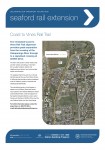
Please find attached (Seaford extension flyer Sept-2012 3) a new temporary detour for the Coast to Vines Rail Trail along Seaford Road which is slightly different from the detour plan that you would have received earlier this month.
Following receipt of some concerns received from cyclists about lack of signage and the number of changes cyclists have to navigate on Seaford Road, we have done a further audit of the temporary detour path. With most of the Seaford Road bridge works on the southern side now complete, you will not that for the most part of Seaford Road, prior to turning onto Grand Boulevard the temporary detour is now on the southern side. In addition, missing signage has now been replaced to better signpost the temporary detour path. Loose gravel that covered some section of path has also been removed by street sweepers and the path will be regularly monitored and ‘cleaned’ as required.
We are still anticipating the final path to be in place at the end of September 2012 when construction works close to the final path will be completed (weather permitting). Asphalting works of the final path will also commence next week.
We thank you for providing your feedback on the temporary detour and hope that the above actions will be a noticeable improvement to cyclists. The final asphalted Coast to Vines Rail Trail is on track to be completed in September 2012.
If you have any further queries, please do not hesitate to contact Zaira or Kath on the Project Enquiry Line on: 1800 791 883 or email: sre.enquiries@tmdjv.com.au Kind Regards Seaford Rail Extension Project Team


